

Outdated federal flood maps leave residents at risk, experts say
Are you in a flood zone? Don’t rely on FEMA to tell you.
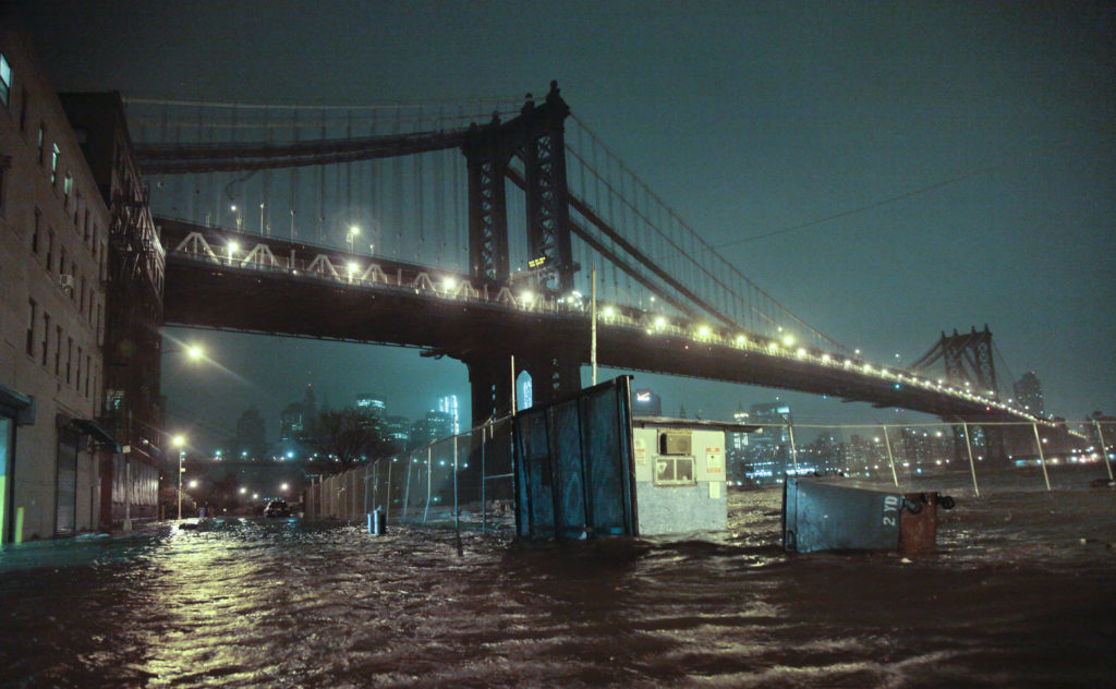
Streets flood in DUMBO during Superstorm Sandy. AP Photo/Bebeto Matthews
With roughly 50 percent of federal flood maps outdated and 75 percent of them older than five years, residents and potential homebuyers are increasingly being put at risk, according to flood experts.
The Federal Emergency Management Agency is required by the National Flood Insurance Reform Act of 1994 to update the country’s flood maps every five years, but they have fallen far behind.
Seven years after Superstorm Sandy, Brooklyn’s federal flood maps are still from 2007. Atlantic City, New Jersey, which was also heavily damaged during the storm, was last mapped in 1983.
“By relying on an outdated map, residents are risking both their physical safety and their financial stability,” said Elizabeth Malone of Neighborhood Housing Services of Brooklyn. “Nothing proved the danger of outdated FEMA maps as well as Sandy did. People did not have flood insurance, and they were not aware of their real risk.”
A 2017 report from the Department of Homeland Security Inspector General’s office revealed that despite FEMA’s goal of having 80 percent of maps up-to-date, only 42 percent of them actually were.
While FEMA’s National Flood Insurance Program did release newer maps after Sandy in November 2012, New York challenged their accuracy. New Jersey did the same soon after.

“When New York City did a deep dive into the modeling and science behind that map, they said this is not adequate; this does not reflect the reality of our risks and we want you to rework it,” Malone told the Brooklyn Eagle.
The federal agency ultimately agreed to create newer maps, but the finalized versions are not expected to be released until 2024, leaving thousands of residents still unaware that they are in a flood zone.
These dated charts — and the risks and consequences they pose to residents — were the inspiration for creating FloodHelpNY, an interactive risk assessment and flood information tool that allows users to see if their address is within FEMA’s advisory flood maps.
New York has taken other preventive measures, as well. The city created a design flood elevation, which requires all buildings to be built two feet above the advisory base flood elevation. Prior to that change, the Buildings Department was approving structures that were not resilient, and would therefore not be insurable.
“It is a complete dereliction of duty on the part of FEMA to have not updated their flood maps for New York City, as they are required to do by law, since 2007,” said Councilmember Justin Brannan, who is also the chairperson of the Resiliency and Waterfront Committee.
“However, I do commend our city for adopting an updated building code in 2015 which takes into account the newly expanded FEMA 100-year floodplain which has helped with smarter resilient rebuilding efforts in areas impacted by Sandy.”
FEMA primarily determines flood zones through an area’s history of flooding, flood insurance claims, elevation data and the position of a property in relation to the established flood level. Its current model, however, does not take into account storm surge, sea level rise and historical hurricanes.
“With more than 22,000 communities participating in the National Flood Insurance Program, FEMA continually examines and updates the nation’s flood hazard data inventory,” a FEMA spokesperson told the Eagle.
The spokesperson said that there are three main methods by which a community’s flood hazard maps are updated. The first is through a FEMA-initiated study or restudy of flood hazards. The second is through a community-initiated revision, and the third is through the Cooperating Technical Partners initiative.
Risk Rating 2.0
While FEMA does continuous updates and tries its best to keep up with the five-year mandate, the agency is falling behind, according to Malone, because it is “woefully underfunded,” especially as climate change accelerates.
The consequence? Some realtors, mortgage brokers and insurance agents are telling residents they don’t need flood insurance.
Citing Sandy, Malone said roughly 50 percent of flood losses were uninsured because people didn’t realize their properties were at risk. Some residents, for example, were and are still being told they are in Zone X, an area of moderate flood risk, which doesn’t require flood insurance, when in fact they are in the Special Flood Hazard Area, which does require insurance.
Seventy-five percent of flood damage takes place in the Special Flood Hazard Area, according to Malone, while 25 percent occurs in Zone X.
New York is ranked as the most vulnerable city to coastal flooding in the U.S., according to a study by Climate Central, but 85 percent of coastal New York City homes that the federal government deems “very vulnerable” to the next natural disaster do not have flood insurance, according to an investigation by THE CITY.

FEMA plans to release “Risk Rating 2.0” next year, which will be enhanced with more sophisticated data, and will take into account storm surge, sea level rise, historical hurricanes and other factors.
The new system is the first change to ratings since the 1970s, according to Malone, who said it was “way overdue.” She argued that the current system incorrectly ranks houses in the New York Harbor region.
“Most of the homes hit by Sandy and Irene remained standing but they are being rated currently as though they were a frame house on the banks of the Ohio — [like] they would be wiped out by 2 inches of water. Our houses took 8 feet of water and didn’t come down,” she said.
Under the current rating system, all houses within the Special Flood Hazard Area receive a blanket rate, but the new system will assess each property on an individual basis.
The new system will include structural consideration, but it will also take into account the cost of rebuilding, which is more expensive in New York and could raise flood insurance rates.
“These [risk rate increases] are going to sink us financially well before the water gets high enough to sink us physically,” Malone said.
Getting the word out
New Yorkers who are unaware of whether they are in a flood zone and who might not buy flood insurance will be hit with astronomical rates once the new maps are released, Malone said.
Malone argued that New Yorkers, therefore, should use FloodRiskNY to determine if they are in a flood zone, and buy flood insurance now while there are more affordable rates. She said her organization has been trying to get the word out, but it has limited resources.
A new bill from Councilmember Eric Ulrich, however, which was introduced on Tuesday at an Environmental Protection Committee hearing, would require the city to alert property owners if they are in the Special Flood Hazard Area after the final flood insurance rate maps are released.
“The city really needs to be a lot more proactive in respect to reaching out to affected homeowners especially those who are currently not in a flood zone, but who will be placed in a flood zone when the final flood insurance rate maps are adopted,” Ulrich said. “They’re in for a very rude awakening when they find out that if they don’t buy flood insurance, they can lose their mortgage.”
Jainey Bavishi, director of the Mayor’s Office of Recovery & Resiliency, however, said that the onus should fall on FEMA to send out an initial advisory, and that the city would be willing to send out a second complimentary notice.
She also suggested that the legislation be reformed so that the mailings go out prior to the flood maps going into effect so that homeowners can get better rates.
Regardless of who sends out the information, Malone said its imperative that people act now before the next natural disaster strikes.
“Mother nature doesn’t read maps or wait for the mapping process,” she said.
Follow reporter Scott Enman on Twitter.

Leave a Comment
Related Articles
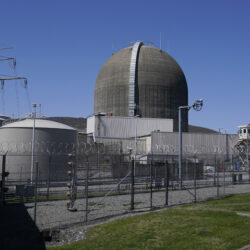
New York governor seeks to build the state’s first new nuclear power plant in decades

Federal judge to deny Trump administration’s motion to dismiss lawsuit over block on wind projects

US peregrine falcons adapt well to city living as their coastal cousins struggle with bird flu
Leave a Comment
We’re glad to see increased awareness about this issue. For absolute clarity on your flood status, we can help. We use superior technology and have expert CFM’s on staff to support. Our comprehensive flood reports are very low-cost, no different than buying something like a CarFax… start your search at MyFloodStatus.com and our team is here to advise on your report.
NYC homeowners and renters: Elizabeth Malone, mentioned in this article, holds FREE home- and flood-insurance workshops in Canarsie, Sheepshead Bay and, for convenience, East Flatbush, Brooklyn, as well as other locations along the coastline. In addition, she also does group presentations, participates in panels, and other community education. Please visit https://www.nhsbrooklyn.org/home-flood-insurance or call 718-469-4679 for more information or to register for a workshop. (See flyer for November/December 2019 schedule.) You may also contact Ms. Malone at [email protected] https://uploads.disquscdn.com/images/466d4b75d66df09935ae5cd9b59264e1823ec3e5e0906d65c0c7461799218988.jpg
NYC homeowners and renters: Elizabeth Malone, mentioned in this article, holds FREE home- and flood-insurance workshops in Canarsie, Sheepshead Bay and, for convenience, East Flatbush, Brooklyn, as well as other locations along the coastline. In addition, she also does group presentations, participates in panels, and other community education. Please visit https://www.nhsbrooklyn.org/home-flood-insurance or call 718-469-4679 for more information or to register for a workshop. (See flyer for November/December 2019 schedule.) You may also contact Ms. Malone at [email protected] https://uploads.disquscdn.com/images/466d4b75d66df09935ae5cd9b59264e1823ec3e5e0906d65c0c7461799218988.jpg