
Escape the city with a winter walk around Shirley Chisholm State Park
Bundle up — and bring lunch.
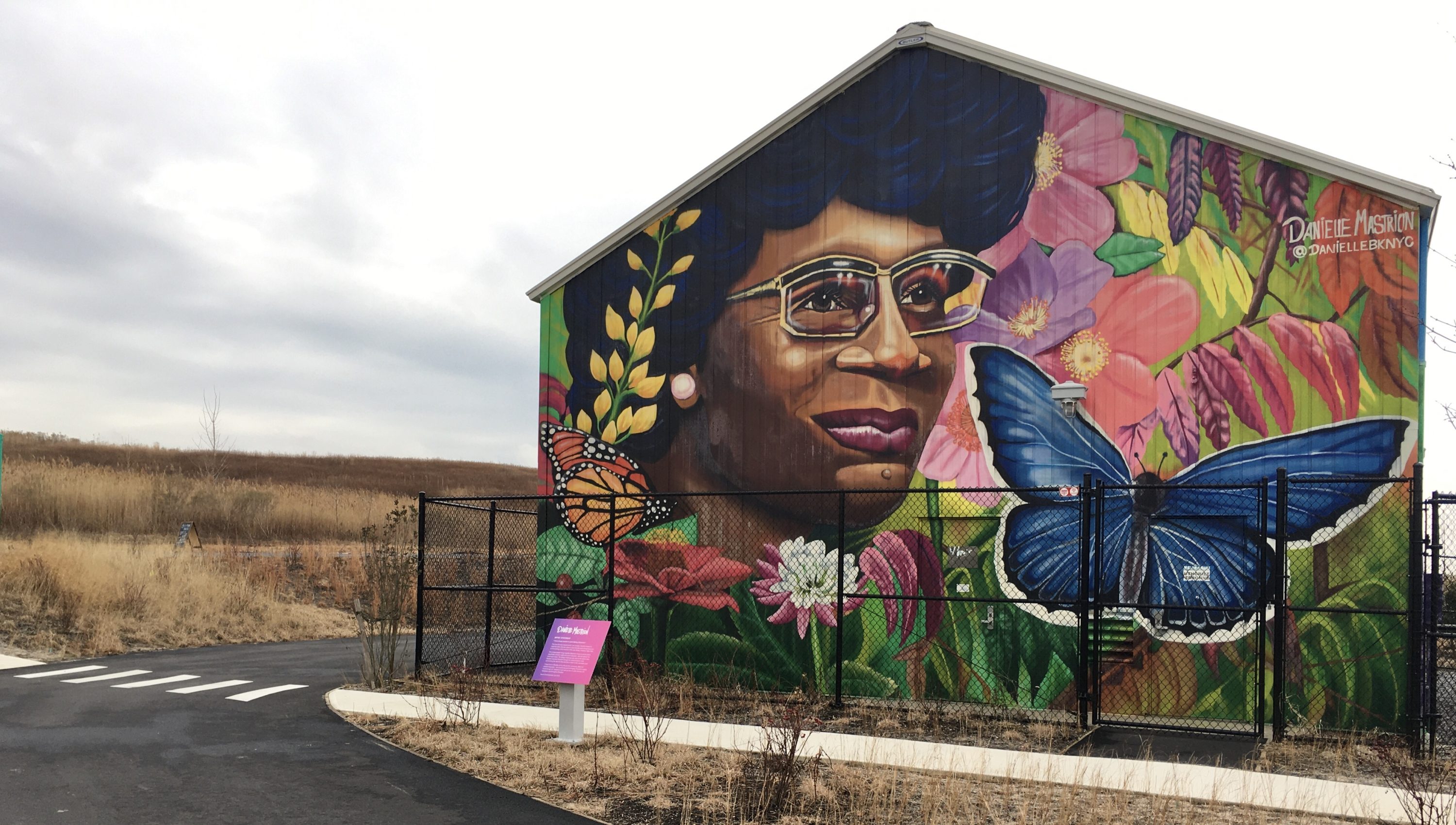
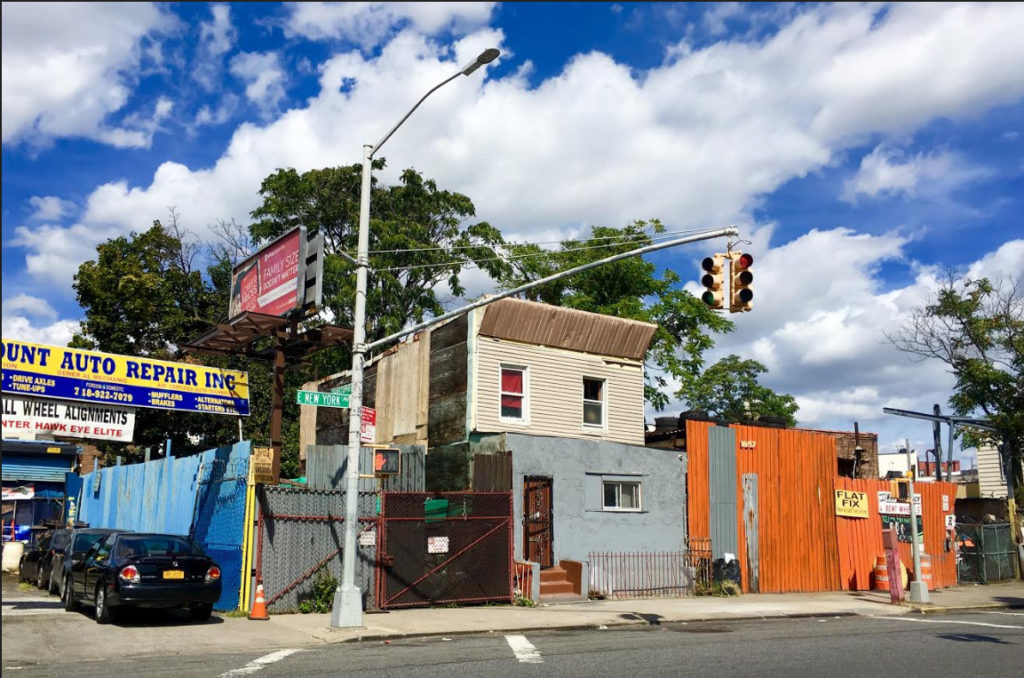
Eye on Real Estate: Have you seen East New York’s new park? It was named to honor the inspirational Shirley Chisholm, the first black woman to serve in Congress and first woman to seek the Democratic presidential nomination.
It’s stunning in the wintertime.
Bundle up — and bring lunch because you’ll wind up spending a long time at Shirley Chisholm State Park. It’s 407 acres in size, which is a lot of ground to cover. And there are picnic tables in spots with jaw-dropping views.
The recreation area on the shoreline of Jamaica Bay, which opened last summer, has high hills where gravel paths for hiking and cycling snake through golden-hued grasses. Pathways also run along the water’s edge. There are piers where you can sit and take in the scenery.
The terrain was created over a period of several years by the city Department of Environmental Protection on side-by-side Pennsylvania Avenue Landfill and Fountain Avenue Landfill. I’ll tell you more about these former garbage dumps in a minute.

Danielle Mastrion’s murals
The park’s vehicular entrance is at the end of Pennsylvania Avenue, just past the Belt Parkway, beside a building decorated with a giant portrait of Brooklyn-born Chisholm. (By the way, Chisholm — whose slogan was “Unbought and Unbossed” — lived in Crown Heights during her 1972 run for president.)
The portrait is the work of Brooklyn painter and muralist Danielle Mastrion. You may have seen her work on the Coney Island Boardwalk. Mastrion’s painting of a multi-colored fish is included in the Ocean Plastic Awareness Mural Project, which is on the facade of the New York Aquarium.
Before I show you around Shirley Chisholm State Park, I should explain how to get there if you don’t live within walking distance.
Take the 3 train to its Pennsylvania Avenue station. Then ride the B83 bus to its stop at the corner of Pennsylvania and Seaview avenues. The park’s Pennsylvania Avenue entrance is nearby.

When I typed the park’s address, 1750 Pennsylvania Ave., into the MTA Trip Planner to prepare for a recent visit, it recommended I ride the bus to a stop that’s a mile away from the park.
The request for directions works better if you input the address 1530 Pennsylvania Ave. as your destination. That’s a building at Spring Creek Towers, a 46-building complex also known as Starrett City, which is right near Shirley Chisholm State Park.
Hendrix Creek Road
When you step inside the park, you’ll immediately get an eyeful of Chisholm’s vibrant portrait.
Mastrion has decorated the other three walls of the building with murals showing some of the plants, birds and animals that thrive in the park.

A saying of Chisholm’s — “Service is the rent we pay for the privilege of living on this earth” — is incorporated into the murals’ design.
There are various paths you can take on this side of Shirley Chisholm State Park, which was formerly the 110-acre Pennsylvania Avenue Landfill.
After looking at Mastrion’s vibrant murals, I decided to head in the direction of Hendrix Creek Road.
The Bike Library
One of the cool things located on Hendrix Creek Road is a shipping container that serves as a base of operations for the park’s Bike Library.
Yes, that’s what this free service is called. Instead of checking out books, you can borrow a recycled bicycle to ride in the park (and you get a helmet, too).

The organization providing this service is Bike New York, a nonprofit that teaches people how to ride bicycles and runs the Five Boro Bike Tour.
The Bike Library is closed for the winter, but I wanted to mention it anyway.
As you walk along Hendrix Creek Road, you’ll hear tall grasses whisper in the breeze and see squadrons of geese fly in tidy formations. The body of water at your left hand is Hendrix Creek.
Penn Pier
Also, speaking of winter, I need to mention that Shirley Chisholm State Park closes early this time of year. Its website says closing time is at dusk. Chalkboard signs on the premises spell out more specific rules.

In the wintertime, you can’t enter the Pennsylvania Avenue side of the park after 3:30 p.m. Closing time in this section of the park is 4:30 p.m.
On the Fountain Avenue side of the park, the last entry time is 3 p.m. and closing time is 4 p.m.
So although the row of fresh, new picnic tables along Hendrix Creek is an inviting place to sit and contemplate nature, keep walking or you’ll surely run out of time to see Shirley Chisholm State Park’s most awesome spots.
For instance, Penn Pier is at the end of Hendrix Creek Road. A photogenic metal walkway juts out from the pier into the waters of Jamaica Bay’s North Channel. Across the water, you can see Fountain Pier, which is covered with a white roof.

There are white-painted picnic tables beside Penn Pier. But once again, I recommend you keep walking.
Dangerous seagulls
I headed up the hill along Penn Ring Drive — and was rewarded with the sight of the sun suddenly coming out. It lit up the golden-grassed landscape like a movie set while storm clouds over Jamaica Bay remained a dark shade of purple.
Off in the distance, the control tower at John F. Kennedy International Airport turned a bright white hue, as though there were floodlights on it.

While I continue walking up Penn Ring Drive and over to the Penn Kayak Launch on the shoreline of Fresh Creek, let me fill you in on some details about the two former landfills that comprise Shirley Chisholm State Park.
They were city dumps for around a quarter of a century. Published accounts give differing dates for their openings and closings.
The hill of garbage at the 297-acre Fountain Avenue Landfill had grown to a height of 140 feet by the time its closing was announced in late 1985.
This mountainous landfill is now capped with impermeable plastic and a below-ground barrier topped by clean soil that’s populated with prairie grass and native plants. You can see it when you’re strolling around the Pennsylvania Avenue side of Shirley Chisholm State Park.
So many seagulls swarmed the Fountain Avenue dump that the Federal Aviation Administration declared them a hazard to JFK Airport’s arriving and departing planes, The New York Times reported in 1985.

The Times story is filled with facts that are distressing to my environmentally conscious sensibilities. For instance:
- At the time of the Fountain Avenue Landfill’s closure, toxic substances were seeping from it into Jamaica Bay.
- In the 1970s, toxic waste oil was illegally disposed of in the Fountain Avenue Landfill. The cleanup cost the city $100 million.
- New York City was legally entitled to dump garbage into the ocean until 1934.
Also, for many years mobsters used the Fountain Avenue Landfill as a burial ground for murder victims, the Times reported in 2006.
Fresh Creek’s lovely shoreline
When I got to the spot on Fresh Creek where the kayak launch is located, I stayed up on Penn Ring Drive and looked at the sandy shoreline and the sunlight glittering on the water.
The beach was lovely. But I didn’t see a footpath to it, so I didn’t walk down there.

Instead, I did an about-face and headed up the hill on Red Tail Trail.
As I ascended, I could see a pathway called Peregrine Trail winding through the prairie grass and down to Penn Pier.
There’s more stuff to tell you about the history of Shirley Chisholm State Park.
For starters, here’s a footnote for folks who are fascinated by autocratic city planner Robert Moses — or the Power Broker, as he’s known thanks to Robert Caro’s biography about him.
In the late 1940s, Moses was behind a city Parks Department plan to create an 885-acre park and nature preserve on a tract of land that included the current Shirley Chisholm State Park site, according to Curbed New York.

Instead, 153 acres of the swampy property was later filled in and used as a site to construct government-subsidized Starrett City, Curbed wrote.
Picnic tables’ panoramic views
You get a bird’s eye view of Starrett City from the top of the hill that Red Tail Trail traverses. In a space between the apartment complex’s buildings, you glimpse the Empire State Building.
There are picnic tables up here — this is where you should stop to eat lunch if you remembered to bring it, and savor the views. A bit further along on the top of this hill, you can see the Verrazzano-Narrows Bridge and a skyline full of skyscrapers including the World Trade Center.

When I was ready to resume my stroll after taking in the views, I continued walking on Red Tail Trail, which led down to the park’s Pennsylvania Avenue entrance where Chisholm’s mural can be found.
The two former landfills that comprise Shirley Chisholm State Park are separated by Hendrix Creek.
To get from the old Pennsylvania Avenue Landfill to the old Fountain Avenue Landfill, you walk on a shared bike and pedestrian pathway on an overpass above Hendrix Creek. This is a good vantage point for taking photos of the creek. Just aim your camera carefully through a protective chain-link fence.

When I arrived at the Fountain Avenue gate, it was a few minutes after 3 p.m. Park workers stationed there did not let me inside. They’re serious about preventing people from accidentally getting locked in the park at closing time, and rightfully so.
One hundred thousand dump trucks
The following day, I returned to the Fountain Avenue side of Shirley Chisholm State Park.
The Department of Environmental Protection spent $200 million on the ecological restoration of it and the Pennsylvania Avenue Landfill. The work began in March 2002 and took seven years, online DEP materials about the project indicate.

There’s now enough clean soil atop the two sides of the park to fill almost 100,000 dump trucks, Shirley Chisholm State Park’s website says.
During my stroll around the Fountain Avenue side of the park, I encountered wintry beauty at every turn.

I decided to walk on Fountain Ring Drive, which runs along the shoreline of Hendrix Creek. That way, I got a long-distance look at the part of the park where I’d been the previous day.
Fountain Pier
Fountain Ring Drive led me to Fountain Pier, which I mentioned earlier. I took lots of photos of the underside of the pier’s roof, whose geometric patterns drew my eye.

The aquatic and shoreline views from Fountain Pier were superb.
Also, the hilltop trails on this side of the park are terrific.
Gov. Andrew Cuomo announced the state’s intention to open the park in his January 2018 State of the State Address.
In April 2019, he included $20 million in the state’s 2020 Enacted Budget to pay for the construction of the hiking and biking trails, the kayak launch, the shaded pier, picnic areas, restrooms, signage and a park office.

Shirley Chisholm State Park is Brooklyn’s third largest public recreation area, behind Marine Park and Prospect Park.
Follow reporter Lore Croghan on Twitter.
Eye on Real Estate is veteran reporter Lore Croghan’s weekly column on Brooklyn’s built environment. Whether it’s old as Abraham Lincoln or so new it hasn’t topped out yet, if a building is eye-catching, Eye will show it to you.
Leave a Comment
Leave a Comment
Are you saying that both sections of the park is now open? That would be awesome!