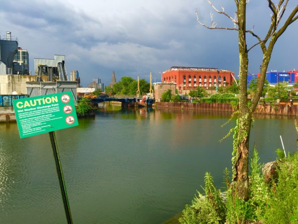
Gowanus business owners within the Industrial Business Zone fear that the looming rezoning could lead to displacement. Eagle file photo by Lore Croghan
By Raanan Geberer
January 30, 2019
Copy Link
Email
Facebook
X
LinkedIn
WhatsApp
Telegram
Pinterest
Print
New York’s Department of City Planning released a rezoning proposal for the Gowanus neighborhood on Wednesday that would establish more stringent standards for climate-resilient development; preserve a mix of commercial, light industrial and housing use for the area; and open up waterfront space, among other developments.
The draft rezoning plan builds on the Gowanus Framework that was adopted in June. A large number of public officials provided input for the framework, including Councilmember Brad Lander, Councilmember Stephen Levin, Brooklyn Borough President Eric Adams, Assemblymember Jo Anne Simon and others. Environmental organizations like the Gowanus Canal Conservancy and Gowanus Green also provided input.
The continuing push to rezone the area has largely been inspired by the fact that in 2010, the Environmental Protection Agency declared the Gowanus Canal, which runs through the area, a federal Superfund site.
The canal has long been recognized as one of the most polluted waterways in the Northeast. The promise of remediation made the neighborhood, previously dominated by manufacturing and low-rise housing, attractive to developers, bars, restaurants and arts-related businesses.
The new zoning proposal, which will have to go through the city’s ULURP process, covers an area roughly bounded by Bond Street to the west; Baltic Street to the north; Fourth Avenue to the east; and Huntington, 3rd, 7th and 15th streets to the south.
Several areas in the southwest area of the neighborhood would be designated as a “Canal Sub-District;” only two small areas, both west of Nevins Street, would be designated as residential; three areas just west of Fourth Avenue and one further west would be designated as industrial and commercial; and a large area, including all of Fourth Avenue, would be designated for mixed-use development.
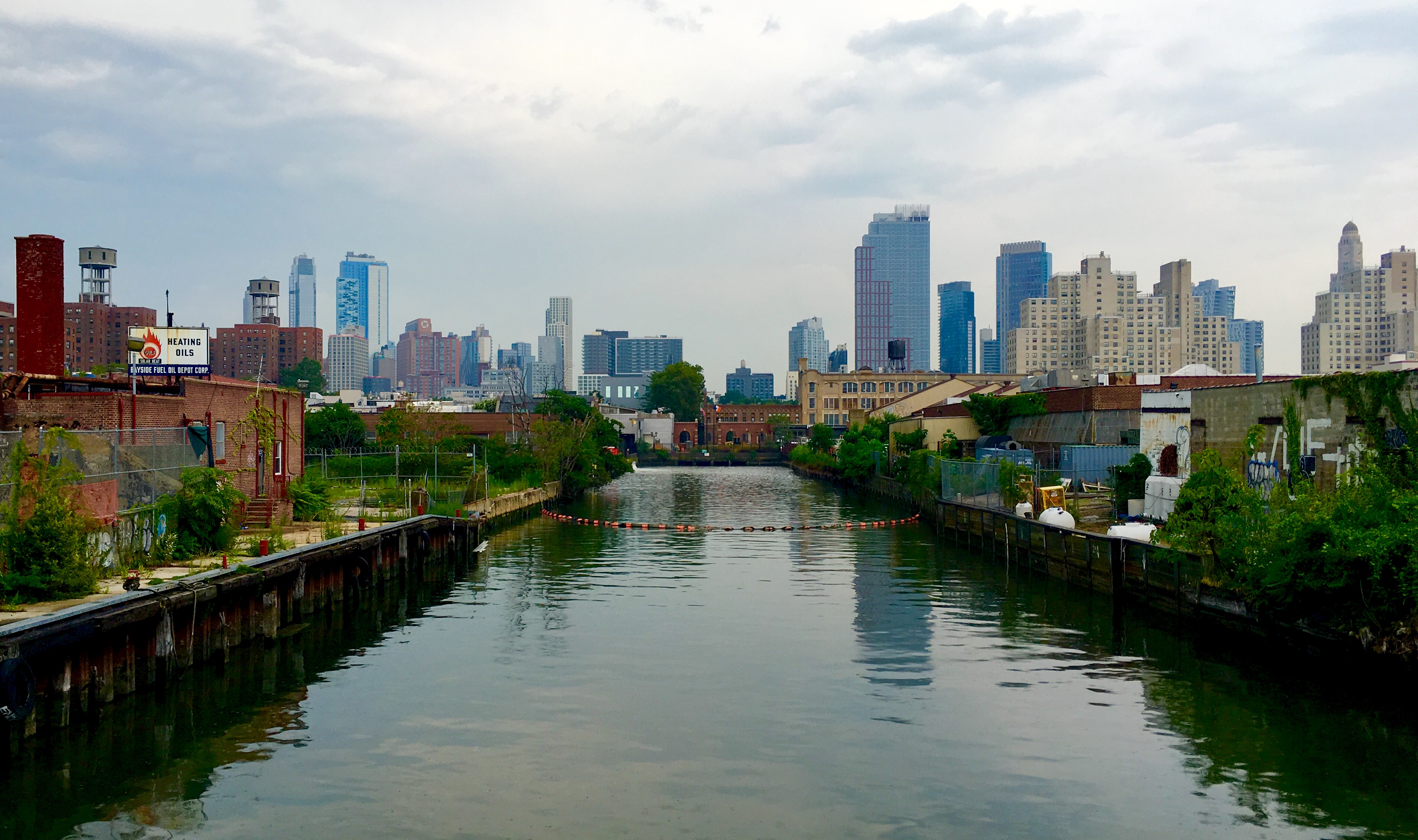
Here’s the toxic but beloved Gowanus Canal, seen from the end of Second Avenue.
Lander, commenting on the new proposal, said, “The Gowanus Draft Zoning Proposal is a strong next step toward the sustainable, inclusive, mixed-use neighborhood that the community has been envisioning for many years.
“I know that not everyone is excited about the idea of new residential and commercial development at heights taller than the surrounding brownstone neighborhoods,” Lander added. “But I genuinely believe we are on the way to getting the balance right.”
DCP’s rendering of Fourth Avenue shows the avenue lined with high-rises. According to DCP, the plan would also ensure some affordable housing.
More city initiatives connected with the plan include:
Elevating the shoreline to protect against long-term daily tidal flooding, while allowing access to the waterfront.
“Ecologically functional design” along the waterfront, including green infrastructure to reduce the impacts of runoff into canal.
Promoting neighborhood open space and schools.
A zoning transit easement on properties above subway stations along Fourth Avenue to support new subway entrances.
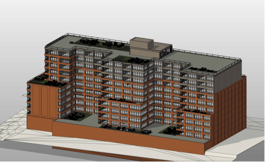
Since the revival of interest in the greater Gowanus area, new buildings have been developed, including Whole Foods, Lowe’s and apartment buildings at 363 and 365 Bond St. However, according to a spokesperson for DCP, any planned new developments will presumably have to be built under the new rules, which still have to go through the city’s review process before they’re finally adopted.
The largest development site in the area is the city-owned Public Place at the corner of Smith and Fifth streets, encompassing nearly 6 acres of vacant land. Public Place is mentioned in DCP’s announcement of the draft zoning plan, which says its rezoning “will facilitate development on the site for affordable housing and complementary uses.”
Several plans have been floated for its use, but the site, once occupied by a manufactured gas plant, needs to be cleaned up first.
Developers of new buildings, according to DCP, would be responsible for disposing of the sewage created by their occupants, but a series of measures by the state Department of Environmental Protection would mitigate the process.
Currently, during rainstorms, rain water combines with household sewage and often floods the area with polluted water.
New combined-sewage infrastructure, DCP says, “will intercept combined sanitary waste and stormwater during wet weather events and pump it back to the wastewater treatment plant.” In addition, new high-level storm sewers have been completed along Third Avenue.
As for the cleanup of the Gowanus Canal itself, dredging and capping of the highly toxic canal bottom must be done first. Last month, city and federal authorities completed a pilot dredging and capping project for the canal’s former First Street Turning Basin. As the Eagle has reported, the actual cleanup won’t likely begin until next year.
A follow-up meeting on “Next Steps in Planning for Gowanus” will take place on Wednesday, Feb. 6 from 6 to 8 p.m. at P.S. 21, 317 Hoyt St.
SUNSET PARK — “As a resident of Marine Park, one of the great surprises I found biking around Industry City and visiting Japan Village was to discover Bush Terminal Park. I continue to be amazed at the serene hideaways that the city offers in some of the busiest places — and, still, with an iconic view.”
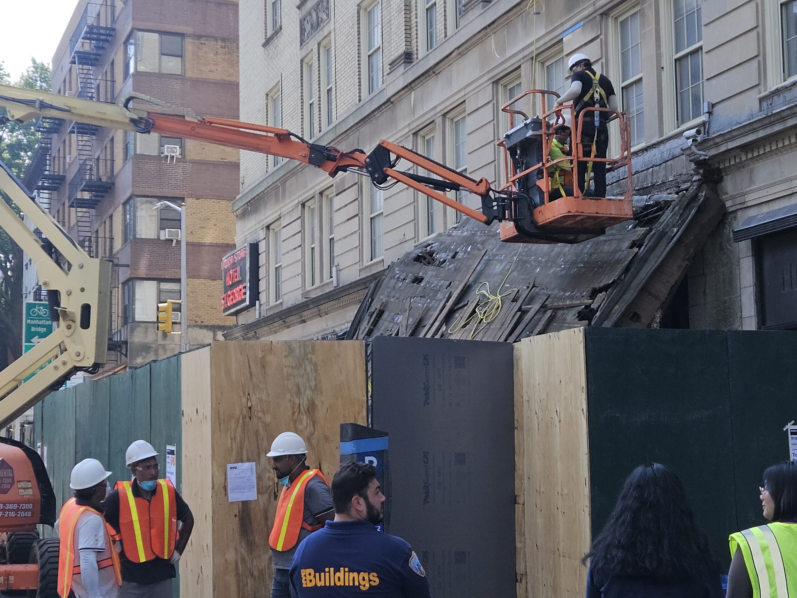
BROOKLYN HEIGHTS — ‘A miracle that no one was killed …’ That’s what neighbors are saying about the collapse of the Hotel St. George marquee. Shown in this photograph are workmen beginning the removal and repair of the historic, old neon sign at the corner, referencing a relic of Brooklyn Heights’ past: the St. George Hotel.
ATLANTIC AVENUE — Exhausted shopper with cluster of bags and goods from mall at Boerum Place stops to look at huge construction site across the street. “Is that REALLY going to be a jail??” Her male companion is reassuring, “Nothing like Rikers … this is 21st Century.”
BROOKLYN HEIGHTS — Overheard in line at one of most popular pastry outlets on Montague Street: “Hope I can get them into a camp …” A mother with two pre-schoolers in tow was showing a friend the Dodge Y flyer for Healthy Kids Day on Saturday, April 18.