Conducted in partnership with the New York City Department of Transportation and Numina, the study utilizes the latest technology — including sensors created by Numina — to collect data on how and why people utilize the Brooklyn Waterfront Greenway.
A scene from West Street in Greenpoint, part of the Brooklyn Greenway, after new trees were planted several years ago. Photo courtesy of Brooklyn Greenway Initiative
The study’s findings show that the greenway is highly used by residents, commuters and visitors within the borough and beyond. It also analyzes the greenway’s potential for environmental and public health benefits for those it serves.
The study, previewed at the NYC Greenways Coalition Summit at the Transit Center in September 2024, marks an important time in greenway planning in New York City, including the anticipated 2024 completion of the first citywide greenways plan since 1993; the planning of 60 new or upgraded miles of greenways over the next two years funded by a grant from the federal Department of Transportation; implementation of the NYC Parks Destination Greenways program; and other projects across the city.
The Brooklyn Greenway near the entrance to Shirley Chisholm State Park in southeast Brooklyn. Photo courtesy of Brooklyn Greenway Initiative
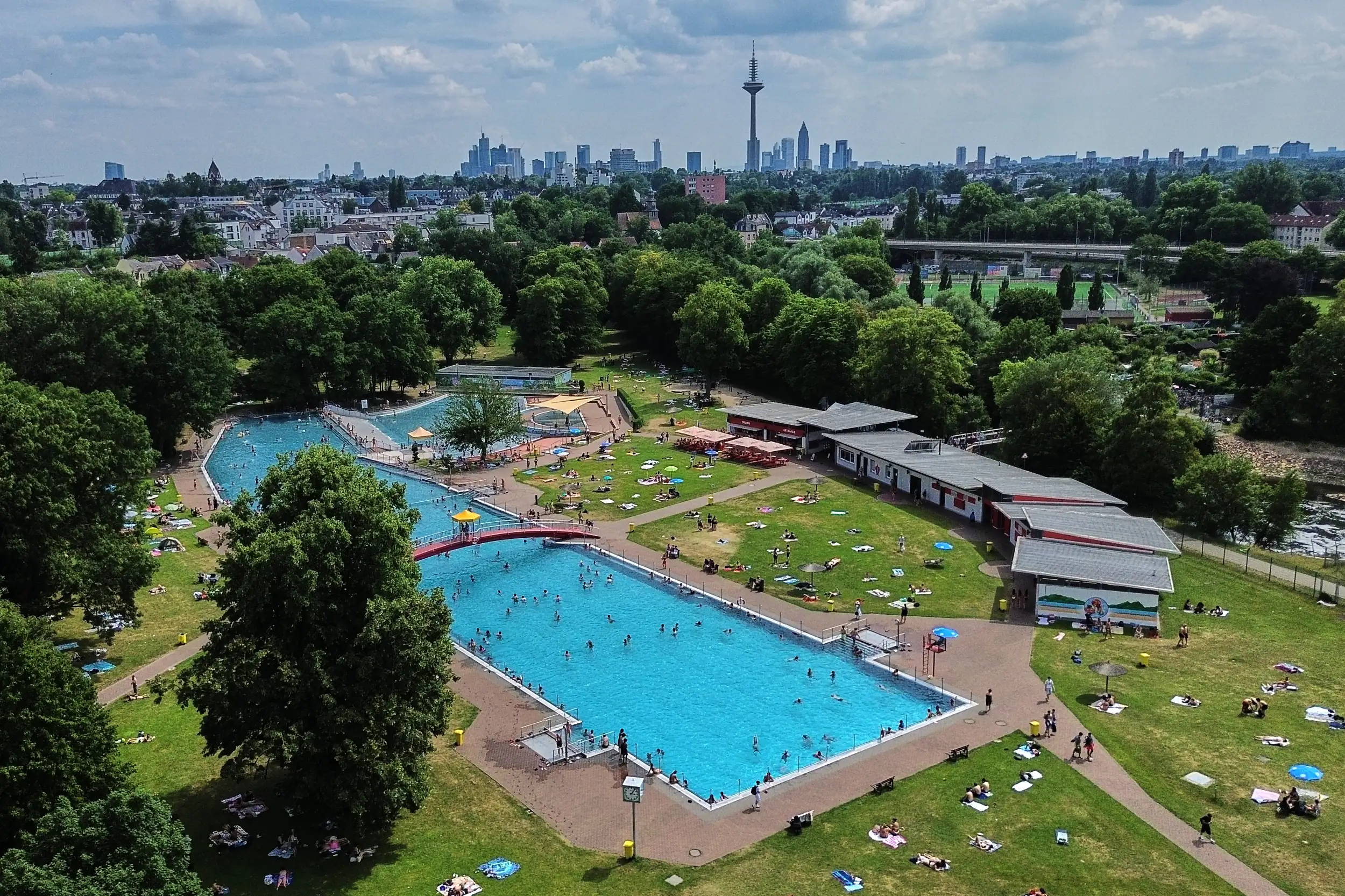
The Brooklyn Waterfront Greenway, which has been under development for more than 30 years, will be a 29-mile corridor once it is completed and will provide a protected and landscaped path that serves pedestrians and bicyclists alike across Brooklyn’s iconic waterfronts. The completed route runs from Greenpoint to East New York.
The study’s findings can be summarized as the following:
Serving as a vital asset for Brooklynites and surrounding communities: Each day, an average of 23,500 bicycles and 36,000 pedestrians utilized the Greenway during its peak month of July 2023. Bicyclists and pedestrians utilized the Greenway for both recreational and commuting purposes, with nearly 75% of users utilizing the Greenway multiple times throughout the week.
Increased public health benefits: An estimated 6,200-16,500 people use the Greenway for exercise every day, with that estimate reaching as many as 21,500 during July. The study also found that out of all users utilizing the Greenway for recreation, 30% would not have made their trip without its existence. For commuters, the study finds that if the Greenway did not exist, nearly 40% of commuters would not have biked or walked to work.
Environmental and resilience benefits: By providing a replacement for automobile transportation, serving as a vital connection to public transit (11% of Greenway users are connecting to transit as compared to 5% for the city as a whole), and through the conservation of public green space, the Greenway offers environmental benefits to its surrounding communities.
The study evaluates the Greenway’s user demographics and usage patterns by breaking the Greenway up into segments and assessing based on neighborhood. Peak usage occurs within Williamsburg/Greenpoint and Brooklyn Navy Yard/DUMBO segments. The eight segments include Williamsburg/Greenpoint; Brooklyn Navy Yard/DUMBO; Brooklyn Bridge Park; Red Hook/Columbia Street Waterfront District; Sunset Park; Shore Parkway Greenway; Coney Island/Sheepshead Bay; and Jamaica Bay Greenway.
“We’ve been studying the benefits of pedestrian and cyclist-friendly infrastructure for decades, and today’s study further validates the environmental, health, and economic benefits that occur when we put our pedestrians and cyclists first,” said Ellis Calvin, data research manager at Regional Plan Association. “We are proud of the groundbreaking work that’s been done so far along the Brooklyn Waterfront Greenway, and look forward to the Greenway’s completion.”
Hunter Armstrong. Photo courtesy of the Brooklyn Greenway Initiative
“Our findings show the importance of completing the final seven miles of the Brooklyn Waterfront Greenway — it’s more clear than ever that the more interconnected and accessible our green spaces are, the healthier, happier, and cleaner our communities can be,” said Hunter Armstrong, executive director of the Brooklyn Greenway Initiative. “We are thrilled that this collaboration with RPA, NYC Department of Transportation, and Numina is now available to the public.”
BGI and RPA’s user study of the essential Brooklyn Waterfront Greenway highlights the potential for its continued development, provides a framework for future user studies and offers construction suggestions based on user patterns, according to the Brooklyn Greenway Initiative.
Hunter Armstrong is the executive director of the Brooklyn Greenway Initiative where he calls on nearly two decades of experience improving public spaces and the public realm in New York City. For more than 20 years, BGI has focused on planning, advocacy, and community engagement for greenways in Brooklyn. In 2016, BGI created the Naval Cemetery Landscape public space, historic site, and pollinator meadow which it fully funds, operates and programs as a green space on the Brooklyn Waterfront Greenway. BGI, a non-profit, is the founding convener of the NYC Greenways Coalition, which includes over 45 greenway-aligned groups. Previously, Hunter worked at the Natural Areas Conservancy, a New York City park conservancy, and CIVITAS, a community-based planning organization in Manhattan where he organized multiple environmental and open space programs, including an ideas competition to improve the East River Esplanade. He has a masters degree in urban and environmental planning from the University of Virginia.
Dr. Sam Bowden Akbari. Photo courtesy of the Regional Planning Association
Dr. Sam Bowden Akbari joined RPA as Director of Communications in 2024. In this role, she develops and executes RPA’s planning vision, strategic messaging, and RPA’s key research publications. Sam brings considerable experience working both in the public’s trust across the federal government, non-profits and higher education, as well as in the private sector via management consulting.
Sam received her doctorate in urban geography from Rutgers University in 2023. While completing her dissertation exploring the politics of public space, she worked with Deloitte as a national consulting writer crafting RFX responses and orals pitches for high-value (over $20 million) opportunities within the Pursuit Center of Excellence. As an urban and regional geographer, she has also published in prominent geography journals and most recently in the book “Spatial Futures.”
SUNSET PARK — “As a resident of Marine Park, one of the great surprises I found biking around Industry City and visiting Japan Village was to discover Bush Terminal Park. I continue to be amazed at the serene hideaways that the city offers in some of the busiest places — and, still, with an iconic view.”
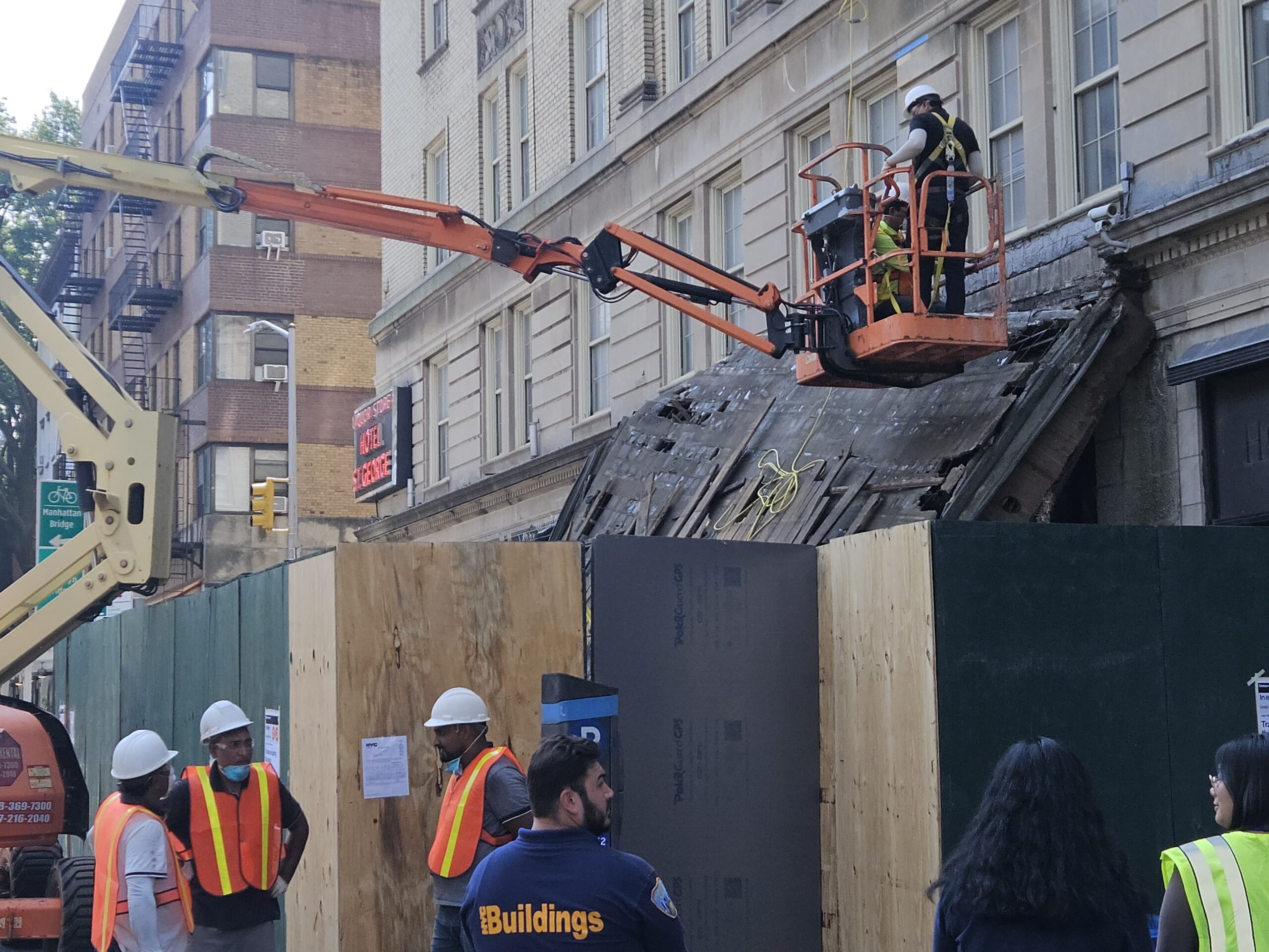
BROOKLYN HEIGHTS — ‘A miracle that no one was killed …’ That’s what neighbors are saying about the collapse of the Hotel St. George marquee. Shown in this photograph are workmen beginning the removal and repair of the historic, old neon sign at the corner, referencing a relic of Brooklyn Heights’ past: the St. George Hotel.
ATLANTIC AVENUE — Exhausted shopper with cluster of bags and goods from mall at Boerum Place stops to look at huge construction site across the street. “Is that REALLY going to be a jail??” Her male companion is reassuring, “Nothing like Rikers … this is 21st Century.”
BROOKLYN HEIGHTS — Overheard in line at one of most popular pastry outlets on Montague Street: “Hope I can get them into a camp …” A mother with two pre-schoolers in tow was showing a friend the Dodge Y flyer for Healthy Kids Day on Saturday, April 18.