Districting commission votes to submit revised plan to City Council
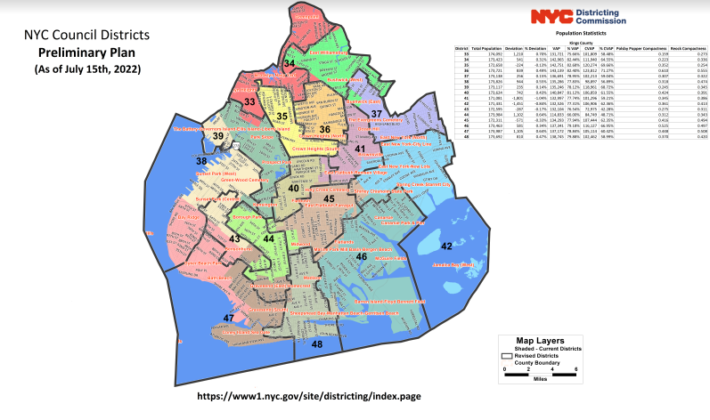
The New York City Districting Commission on Thursday voted 13-1 to submit 51 newly drawn City Council district maps to the City Council. These maps were revised from the preliminary plan published by the Commission in July and a proposed revised plan in September that was not approved by the Commission. View Maps
The maps represent a response to over 12,500 submissions offered by New Yorkers in person or via Zoom during more than 35 hours of public hearings; by email; and by regular mail. A new plan is drawn by the Districting Commission every ten years following the U.S. Census. The Commission is made up of 15 members appointed by the Mayor and the City Council. The Commission drew this plan following the requirements under the U.S. Constitution, the Voting Rights Act of 1965 (VRA), state law, and the City Charter of New York.
The challenge in drawing these plans this year was the city’s explosive population growth to 8.8 million according to the 2020 Census: the city grew by 630,000 people – the equivalent of the entire population of the city of Memphis. Fifty-five percent of this new population is Asian. Twenty-four percent is Hispanic.
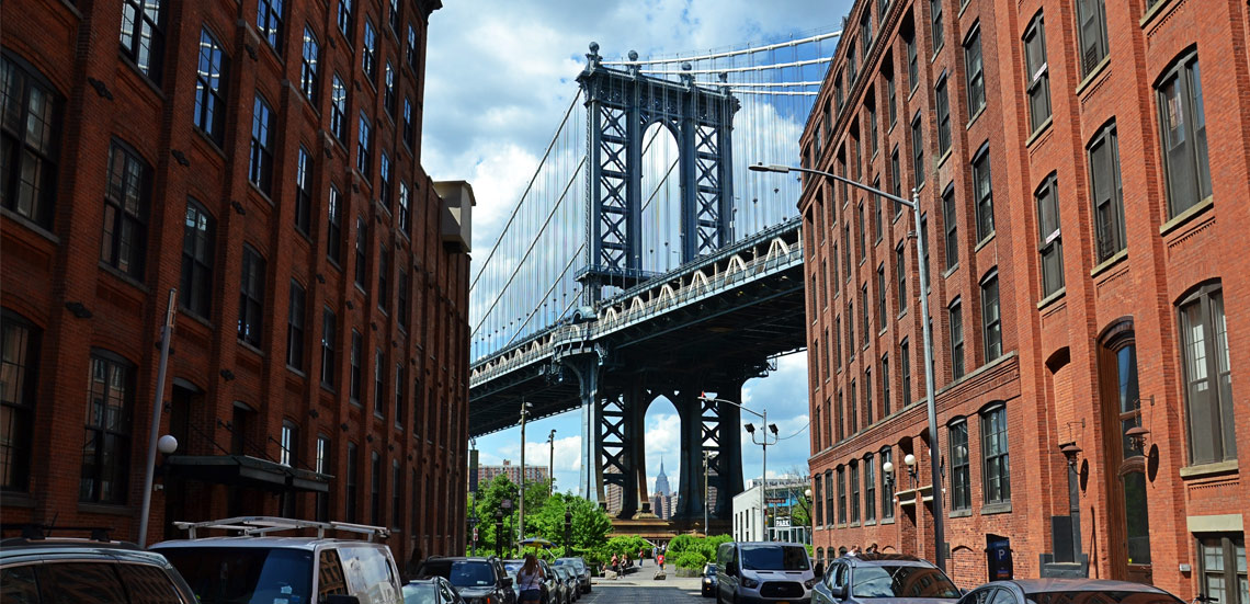
Brooklyn Boro
View MoreNew York City’s most populous borough, Brooklyn, is home to nearly 2.6 million residents. If Brooklyn were an independent city it would be the fourth largest city in the United States. While Brooklyn has become the epitome of ‘cool and hip’ in recent years, for those that were born here, raised families here and improved communities over the years, Brooklyn has never been ‘uncool’.