See it: Rendering of BQE ‘Parallel Highway’ plan released
DOT mulling Brooklyn Heights Association proposal
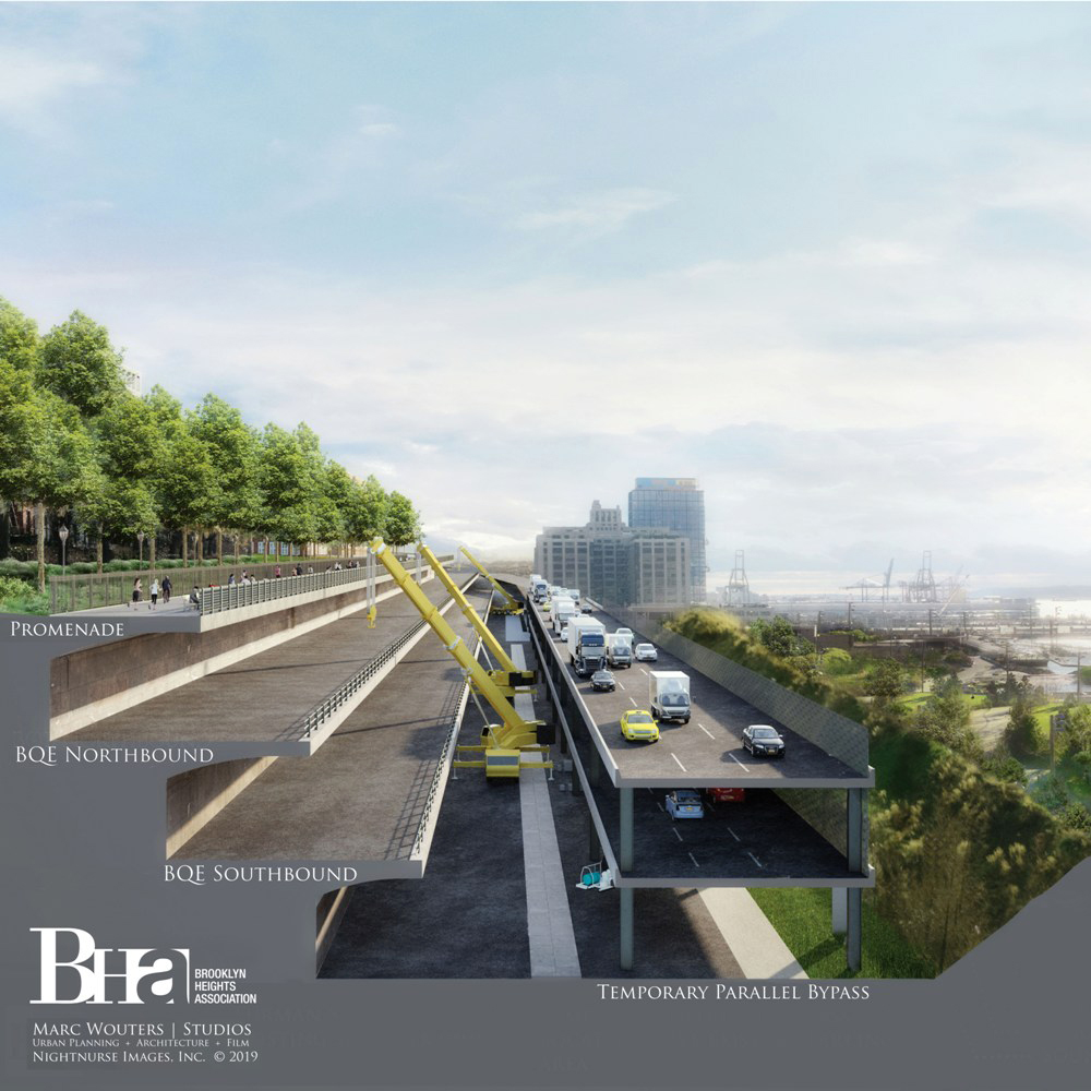
The Brooklyn Heights Association has released a rendering of its alternative to the city’s controversial plan to temporarily replace the landmarked Heights Promenade with a six-lane highway. The proposal, dubbed the “Parallel Highway” by BHA, can be seen to the right on this rendering. The plan was conceived by Heights-based Marc Wouters Studios.
Rendering courtesy of Marc Wouters Studios
The Brooklyn Heights Association has released a rendering of its alternative to the city’s controversial plan to replace the landmarked Heights Promenade with a six-lane highway.
The Promenade plan, preferred by the NYC Department of Transportation, would temporarily raise the interstate — and its pollution — to neighborhood street level during the six- to eight-year $3.4 billion reconstruction of the Brooklyn-Queens Expressway (BQE).
The BHA’s alternate plan, dubbed the “Parallel Highway,” was conceived by Heights-based Marc Wouters Studios. It would move traffic to a temporary two-level structure west of the existing triple cantilever, rather than atop the popular landmarked walkway.